|
Climate Shift Maps & ArcGIS Shapefiles
About Maps & GIS: Maps are critical to our understanding of the effects and impacts of climate change and how we will adapt. In addition to the map resources below, there are maps that you may download in PDF, jpg or similar image formats or you can create your own using free resources. If you wish to make your own, begin by downloading the GIS shapefiles we have here for you. If you are new to GIS and mapmaking, check this brief introduction. Using this free tutorial, learn to make your own GIS maps. Lastly, there are plenty of free GIS software programs available as well as many free ArcGIS shapefiles you can use to create your maps.
With these you may:
- Compare temperature changes throughout the year, month by month.
- Compare precipitation changes throughout the year, month by month.
- Combine the above and see where and when it's likely to snow or rain.
- Look at temperature changes and determine when a heavy snowpack might thaw quickly and early resulting in flooding.
- Look at temperature changes and detemine what might be the best vegetables to grow.
- Examine temperature changes and see what affect that might have on my land - wildlife and plantlife changes over time.
These are just a few examples. To learn more, check out the climate change GIS shapefiles I have created. You don't have to be an expert GIS guru. I provide a free GIS Tutorial and Atlas. It comes with access to free GIS software and it will get you up to speed quickly so that you can make your own climate change digital maps.
International Nuclear Safety Center Interactive Web Maps
Carbon Sequestration Atlas of the United States and Canada
Download Extreme Weather & Disaster Geography Maps
Free climate change and energy related maps to download in PDF, jpg or similar image formats
Free ArcGIS GIS shapefile map layers to download and use to make your own maps
2009 Climate Impacts in the United States Maps, Charts and Tables
Climate Change and Sea Level - Shoreline geomorphology, erosion, deposition, and subsidence, tide range and wave height, engineered structures such as jetties and seawalls, and elevation above sea level are some of the many factors that determine the degree to which a coastal area is susceptible to sea level rise. Of these, elevation data are available for any location of the globe and are very effective in depicting and communicating to the public areas that may be susceptible to sea level rise.
GIS Climate Change Scenarios project is conducted by the NCAR GIS Initiative and intended to serve a community of GIS users interested in climate change. This GIS data portal provides access to free global datasets of climate change scenarios generated for the 4th Assessment Report of the Intergovernmental Panel on Climate Change (IPCC) by the Community Climate System Model (CCSM). The datasets can be downloaded in a common GIS format (i.e., shapefiles) or text file format. Currently, our GIS portal distributes a subset of all the data produced by the CCSM. One can view and/or download global monthly mean, 2D atmospheric and land variables from the CCSM component models.
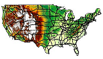
NOAA Spring 2007 Outlook Maps - Temperature, Flood Risk, Precipitation and Drought.
CarbonTracker
CarbonTracker is a system that calculates carbon dioxide uptake and
release at the Earth's surface over time. It estimates the carbon
dioxide exchange from an 'atmospheric point of view'. Since CO2 mole
fractions in the atmosphere reflect the sum of all the CO2 exchange at the
surface, they form the ultimate record of the combined human and natural
influence on greenhouse gas levels ... More Information
Review and Atlas of Palaeovegetation
Preliminary land ecosystem maps of the world since the Last Glacial
Maximum. A set of preliminary, broad-scale ecosystem map reconstructions is presented for the world at the Last Glacial Maximum (18,000 14C years ago) and the early Holocene (8,000 14C years ago), the mid Holocene (5,000 14C years ago) and for comparison 'present-potential' maps that may be regarded as approximating the late Holocene vegetation distribution as it would - or might - have been without agricultural modification. The maps were produced through consultation with an extensive network of experts and a range of literature and map sources, with the final decision in each case made by the editors. Accompanying each regional map is a general background text detailing the principal sources of evidence and the major uncertainties within this ... More Information
US Geothermal Projects and Resource Areas
US map showing where the direct use projects are located. This is a
clickable map where you can find information concerning each direct
use site. Just click on a state to get information for that state or click
on the Direct Use icons at the bottom to get a listing of all the projects
for that direct use ... More Information
NOAA Thermal Springs Geothermal Website
The Thermal Springs List is available on-line as a Virtual Map of Thermal Springs, an experiment in Web-based mapping. You'll need a high speed connection for this. Geothermal energy is heat derived from Earth's interior. Resources may include hot springs and wells, hot dry rock, and even molten rock. These may be converted into heat and electricity ... More Information
EdGCM Project
The EdGCM Project develops and distributes a research-quality global
climate model (GCM) with a user-friendly interface that runs on desktop
computers. Anyone can explore the subject of climate change using the same
methods and tools that scientists employ ... More Information
The National Digital Forecast
The National Digital Forecast Database (NDFD) is a database put
together by the National Weather Service (NWS) to provide forecasts
of sensible weather elements (e.g., cloud cover, maximum temperature) on a
seamless grid. The NDFD is currently given out to the public as a GRIB2
file ... More Information
NOAA Spring 2007 Outlook Maps
Temperature, Flood Risk, Precipitation and Drought... More Information
Climate Change and Sea Level
Maps of Susceptible Areas -
Shoreline geomorphology, erosion, deposition, and subsidence, tide range and wave height, engineered structures such as jetties and seawalls, and elevation above sea level are some of the many factors that determine the degree to which a coastal area is susceptible to sea level rise. Of these, elevation data are available for any location of the globe and are very effective in depicting and communicating to the public areas that may be susceptible to sea level rise... More Information
Map of Early Warning Signs
The map of early warning signs clearly illustrates the global nature of climate changes. In its 2001 assessment, the Intergovernmental Panel on Climate Change (IPCC) concluded that, ?an increasing body of observations gives a collective picture of a warming world and other changes in the climate system."
While North America and Europe�where the science is strongest�exhibit the highest density of indicators, scientists have made a great effort in recent years to document the early impacts of global warming on other continents. Our map update reflects this emerging knowledge from all parts of the world... More Information
Teaching Materials for Map of Early Warning Signs
This set of teaching materials is designed to accompany Global Warming: Early Warning Signs - a science-based world map depicting the local and regional consequences of global climate change. The map was produced as a collaborative project by several environmental organizations, and has been peer-reviewed by scientists.
The Union of Concerned Scientists produced this Curriculum Guide. Geared towards students and teachers in grades 9-12, individual exercises are adaptable to different grade levels. Each activity is structured to include an initial ?Engagement? exercise, one or more steps of a Student ?Exploration? project, and further ideas for extended study. The materials align with National Learning Standards for Science, Geography, Social Studies, Language Arts, Environmental Education, and Technology... More Information
The Atlas of Canada: Climate Change
Over the past 150 years, abundant scientific data has demonstrated that the earth's climate has become warmer, and that the warming has been accelerating over the past two decades. This change in the climate has become a global issue of concern. This map series aims to provide policy makers, researchers and the general public with a geographical perspective to climate change. The series also attempts to integrate human activities and the environment, and links science and government policy... More Information
UNEP: United Nations Environmental Program Maps and Graphics: Climate
Sampling of what is to be found includes: Temperature and CO2 concentration in the atmosphere over the past 400 000 years, Climate change vulnerability in Africa, Climate change impact on mountain vegetation zones, Freshwater stress and risk, Malaria risk and climate change, Potential dengue transmission in case of temperature rise, Causes of sea level rise from climate change... More Information
UNEP: United Nations Environmental Program Maps and Graphics: Greenhouse Gas Emissions
GRID-Arendal has produced graphs documenting countries' historical (reported in 2005) and projected emissions, with the Kyoto target as a point of reference. The data is as reported and published by the secretariat of the United Nations Framework Convention on Climate Change (UNFCCC) in 2005... More Information
<-- Back to Climate Shift
Contact: [email protected]
Privacy, Fairuse & Disclaimer
Note: Be sure to visit our sister site for Climate Change Archives and more related info.
|